
West Falls Church ZIP Code Directory Coverage
The ZIP code directory begins with only the local examples verified in official Fairfax parcel records. The research supports 22042 and 22043 as active West Falls Church-area postal examples. It identifies 22044 as a nearby Falls Church postal area, not as a ZIP that can be described as wholly within the CDP. USPS, not an old mailing label, supplies the current delivery result for a particular address. A ZIP serves postal delivery, while the CDP, Fairfax County, Falls Church City, precinct, and planning area follow different lines.
| ZIP | Verified area examples | Postal confirmation | Boundary caution |
|---|---|---|---|
| 22042 | West Falls Church-area Fairfax addresses, including Westfall Place and Route 29 examples | Use USPS address lookup; a station name was not captured | Parcel and CDP boundary still require a county check |
| 22043 | West Falls Station and Pimmit-area Fairfax examples, including West Falls Station Boulevard | Use USPS address lookup; station label was not captured | Planning and transportation areas do not create a city boundary |
| 22044 | Nearby Falls Church postal area | Verify by USPS address or city-and-state result | Do not treat it as complete West Falls Church CDP coverage without address-level confirmation |
No official source reviewed supplied a complete ZIP-by-CDP list, a named station for each ZIP, a unique-ZIP classification, or a verified realignment year. That gap is important. The table is a set of verified local examples, not a claim that every address bearing one of these ZIP codes is inside West Falls Church.
West Falls Church Postal Checks
The USPS ZIP Lookup offers By Address, By City and State, and Cities by ZIP modes. By Address is the strongest first check when a complete street address is known. It returns a postal match, but USPS warns that it does not confirm a person or company is actually at that address. That limitation keeps a ZIP code search focused on postal delivery and address normalization rather than a resident list.
| USPS field or mode | Input type | Required | West Falls Church use |
|---|---|---|---|
| Street | Address text | Yes for By Address | Enter the delivery street before comparing it to county situs data |
| Apartment or suite | Address text | No | Add it when a unit is part of the postal address |
| City and state | Location fields | Yes for By Address | Test the postal label, then separately confirm Fairfax County or city jurisdiction |
| ZIP | Postal number | No in the address form | Use to check or compare an existing delivery code |
| Cities by ZIP | ZIP query | Yes in that mode | Useful for postal associations, not a legal-boundary decision |
USPS also exposes an optional company field and, on some page variants, an urbanization field. Keep those supplemental fields out of an identity conclusion. If the postal result conflicts with a parcel record, save both results and use the county address authority or the record custodian to resolve the jurisdiction question.
Note: A ZIP code confirms postal routing for an address, not the occupant, owner, court venue, election precinct, or municipal government.
Finding West Falls Church Records by ZIP
Fairfax tools use different keys. iCare is an address, map-number, and map-search system, not a ZIP-wide resident directory. Jade uses address, PIN, subdivision, intersection, layer, and map selection rather than ZIP as its primary key. The Fairfax ZIP demographic mapper accepts address, place, and ZIP modes, which makes it useful for geographic context. Election tools are also not a ZIP list: the Citizen Portal is a personal status workflow, and voter-list distribution is controlled by Virginia law.
- Run the complete address through USPS and record the returned ZIP without treating it as proof of a person at the address.
- Search the address in iCare or Jade and copy the PIN, situs, tax-map information, and deed reference shown by the county record.
- Use the Fairfax ZIP mapper to compare the postal area with the address, place, and surrounding county geography.
- Check the official precinct or locality result by address when election geography matters, then use the correct custodian for any controlled record request.
Once the postal area has narrowed an address, the street-level property trail belongs in the West Falls Church streets directory. It follows the address and PIN rather than trying to infer ownership or occupancy from a ZIP alone.
West Falls Church ZIP Parcel Keys
A Fairfax PIN is more durable for property research than a ZIP. It may appear as `0504 17 0215` or `0501 01 0039D`, with spaces and letters that identify tax-map grid and parcel components. Copy the PIN exactly from iCare or Jade. Deeds and planning material may instead use a lot, block, subdivision, tract, plat, or metes-and-bounds description, especially when a current street address is missing or has changed.
The Fairfax Digital Map Viewer supplies official property-map images through tax-map grid, address, interactive-map, and map-year paths.
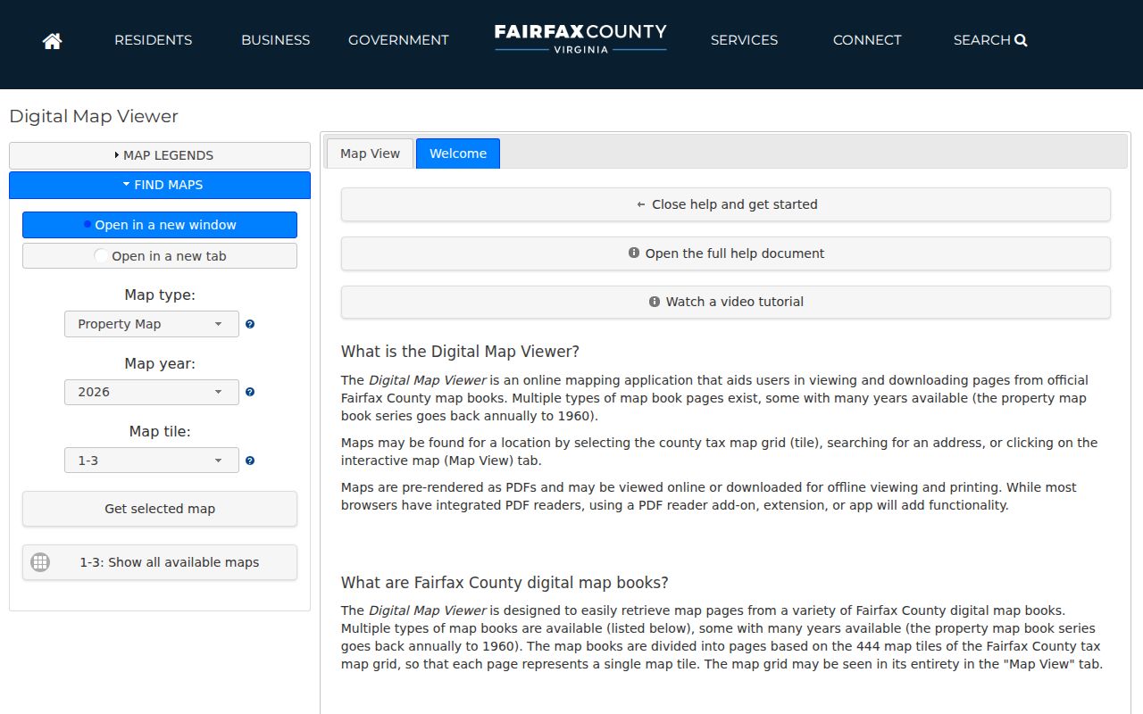
The viewer supports a parcel-centered check when a postal address falls near a boundary or when a historical map is needed to compare the location over time.
West Falls Station provides a useful local quirk. Planning material names parcels with PIN-style identifiers and describes two parcels with no assigned address. An address-only query can miss that land, while the parcel identifier can connect the planning record, tax map, and deed trail. A mailing label and a ZIP are not substitutes for that identifier.
West Falls Church ZIP Boundary Checks
West Falls Church is a Fairfax County CDP, not an incorporated West Falls Church city. Falls Church City and Fairfax City are independent jurisdictions. A Falls Church postal label may therefore describe a delivery area that crosses the county or city lines a court, tax, or administrative record needs. The safest sequence is postal address, county situs, PIN, jurisdiction, then the appropriate record system. Do not use a ZIP or mailing city as the only locality filter.
- ZIP versus ZIP+4
- A ZIP identifies a broad postal delivery area. ZIP+4 adds a smaller delivery segment and does not establish a government boundary.
- PO box ZIP
- A postal code used for post-office boxes. It does not show a person’s residence or the location of a parcel.
- Unique ZIP
- A ZIP assigned to one organization or destination. No unique-ZIP classification for West Falls Church was verified in the research.
- Carrier route
- A postal delivery sequence within an area. It is not a parcel, precinct, or city-limit line.
Boundary reminder. Confirm county or city jurisdiction with the situs and PIN before using a West Falls Church ZIP in a court, deed, tax, or request search.
West Falls Church ZIP Mapper Context
The Fairfax ZIP and demographic mapper works by address, place, or ZIP. It is a comparison tool for postal geography, not proof of a legal boundary or a roster of residents. Compare it with parcel layers, precinct information, and the CDP or city lines when a result needs a precise local interpretation. Seven Corners, Pimmit Hills, West Falls Station, and the Falls Church City edge make those distinctions especially useful in this part of Fairfax.
The captured Fairfax ZIP mapper screen shows the county’s address, place, and ZIP search routes.
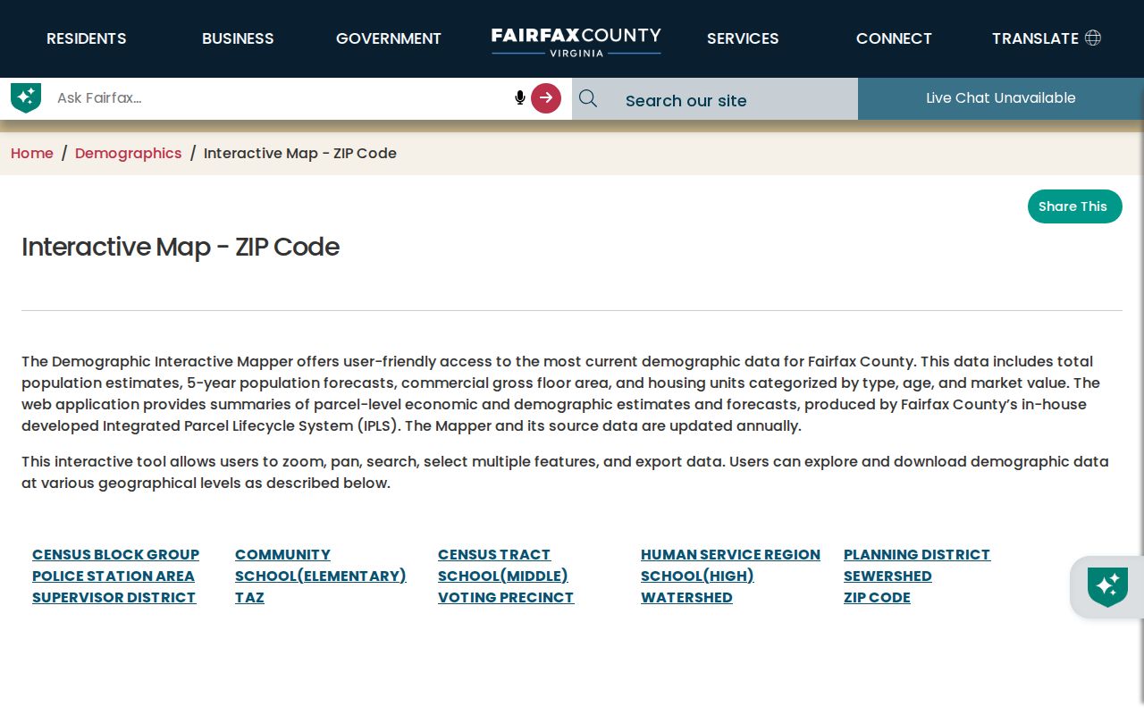
Use the mapper after an address is normalized, then preserve the parcel result and date of the check with any request or research note.
West Falls Church Address Changes
No verified ZIP realignment year was found for West Falls Church. For a suspected historical change, compare current USPS output with Fairfax’s Master Address Repository, historic tax maps, address points, aerial imagery, and planning records. A postal update does not demonstrate a city annexation. The county announced a new or improved mobile-friendly Master Address Repository in July 2026, and its Historical Imagery Viewer includes 2025 aerial photography within an imagery history reaching back to 1937.
That record sequence is useful when a past directory, map, or deed names an older address form. Record the historic postal line as a dated clue, but search the PIN, subdivision, lot, or legal description if the current address no longer aligns. The directory remains a postal starting point, not the final property identity.
West Falls Church Postal Comparisons
Several overlapping labels can describe the same general area, but each answers a different question. Keeping them separate prevents a postal result from being treated as a government record or a parcel result from being read as household information.
| Label | What it identifies | Best record use |
|---|---|---|
| ZIP | Postal delivery geography | Validate a mailing address through USPS |
| PIN and situs | A Fairfax parcel and its property location | Assessment, map, deed-reference, and tax research |
| CDP or city boundary | Census place or incorporated government jurisdiction | Select the right county or city record custodian |
| Precinct or planning area | Election or planning geography | Address-specific civic or planning context |
Note: The same Falls Church postal wording can point to a CDP, Fairfax County address, independent city, planning district, or historic directory scope.
West Falls Church ZIP Record Requests
When the online tools do not resolve an address, contact the custodian that holds the existing record. USPS handles postal output. Fairfax mapping and property staff handle county address and parcel context. The Circuit Court and Historic Records Center handle land-record routes, while Fairfax Elections handles controlled election questions. Libraries and the Library of Virginia can help locate historical directories, maps, and microfilm when an older postal line needs context.
A Fairfax County VFOIA request should name the agency, exact street segment or situs, PIN where known, ZIP, date range, record category, format, and any request for a cost estimate. Virginia FOIA concerns existing records; it cannot require a new ZIP-boundary analysis. The normal response framework is five working days, with a timely delay notice allowing up to seven additional work days.
Use phone, email, mail, in-person counters, library staff, and state repositories as the documented fallback channels. Keep the original postal result and the parcel or map result together so the next office can see exactly where the mismatch arose.