
West Falls Church Neighbors by Block
The immediate block has several record layers. Jade identifies the subject parcel, surrounding polygons, address points, right-of-way, common areas, subdivision, zoning, and district overlays. iCare gives each parcel’s owner, mailing and situs fields, assessment, sale, deed references, and physical characteristics. A recorded plat or deed decides legal boundaries. The Virginia Room’s dated community directories provide a historic clue only. Fairfax My Neighborhood describes public services and elected offices around an address, but it does not identify people on adjoining parcels.
| Block source | What it can establish | Access |
|---|---|---|
| Jade parcel map | Subject parcel, adjoining polygons, address points, right-of-way, common areas, districts | Free map, selection, buffer, table, and bounded export |
| Jade Parcel REST | Official parcel IDs and layer attributes for a small neighbor query | Public query, identify, and export; 2,000-record maximum |
| iCare property record | Owner, mailing and situs addresses, assessment, sale, and deed reference | Free address or map search |
| Recorded deeds and plats | Legal boundaries, lot or block, easements, and parties at recording dates | Courthouse, CPAN, and Historic Records Center |
| Civic directories | Historical community or address snapshots, subject to edition scope | Virginia Room reference holdings |
| My Neighborhood | Precinct, elected officials, schools, and nearby public facilities | Free address report, without names of adjoining people |
Ownership is not the same as present residence. A result can also be a government parcel, utility parcel, corporate property, road, or shared open space. Records on that block are best understood through a bounded parcel method and a source-by-source date check.
Map West Falls Church Neighbor Parcels
Use the subject address or PIN in Jade, then map outward only far enough to answer the block question. Search, select the parcel, and switch on Parcels, Address Points, Right of Way, Common Areas, and Subdivisions. Click selection or Buffer Options collects nearby features. Table view lets a researcher record PINs, and the export controls support a small documented selection. A street-only search is not enough when the relevant edge is a cul-de-sac, common tract, or separate right-of-way.
- Locate the address or PIN in Jade and open the subject parcel report.
- Turn on the adjacent parcel, address-point, right-of-way, common-area, and subdivision layers.
- Use click selection or a small buffer, then record the PINs shown in Table view.
- Open each parcel report for owner and deed references, keeping mailing and situs fields separate.
- Use a deed or plat to test legal adjacency when a line, easement, road, or shared parcel sits between properties.
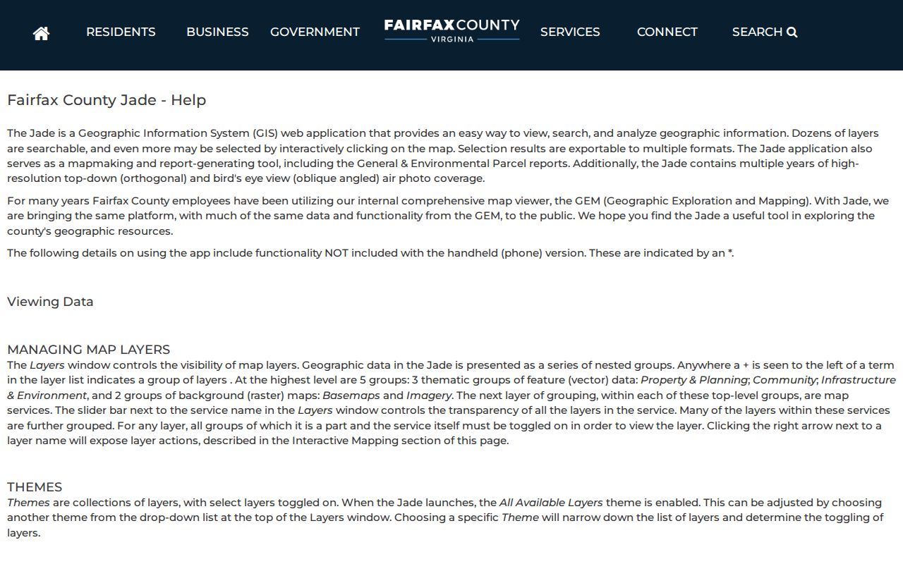
Jade’s official help page describes the search, map-selection, table, buffer, and export functions.
The resulting parcels are starting points for a record check. For a full named-street trail, use the West Falls Church Street Directory rather than extending a small block buffer beyond its purpose.
Boundaries Around West Falls Church Blocks
Nearby is not a single legal category. Adjacent parcel, same subdivision, same ZIP, same civic directory, and same election precinct describe different relationships. A parcel sharing a boundary may be a road, common area, association-owned property, government land, or a utility parcel rather than a home. The Parcel REST layers include parcels, right-of-way, subdivisions, common areas, owner categories, and tax-map grid, which makes the distinction visible before a land-record search begins.
West Falls Church is a Fairfax County census-designated place. A Falls Church mailing label may also refer to a postal area or Falls Church City. West Falls Station planning records show another reason to use the PIN: some planned parcels have no assigned address. Check situs or PIN, county or city jurisdiction, ZIP, precinct, planning area, and subdivision before describing any nearby relationship.
Fairfax’s Parcel REST MapServer provides the official map layers used for a bounded query.
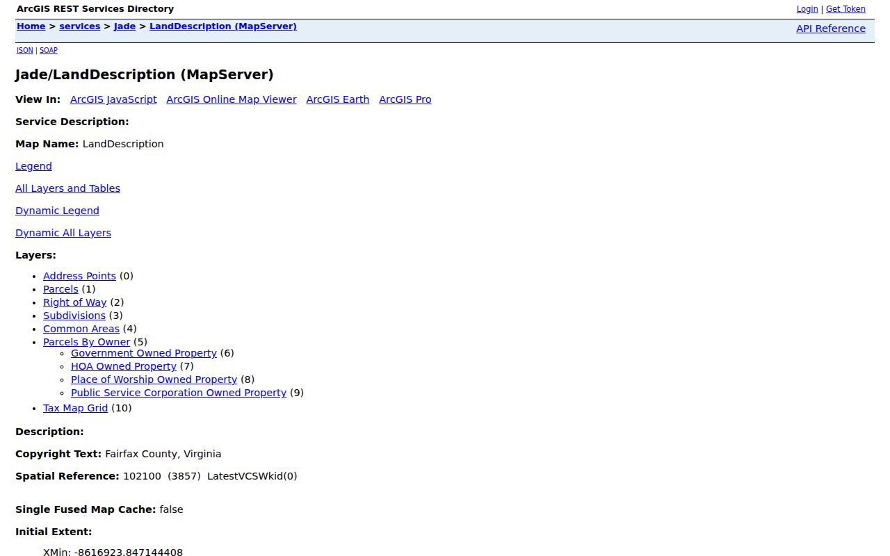
Use the REST export formats only for a focused selection. JSON, GeoJSON, and PBF are available, but the documented 2,000-record cap is a reason to keep a neighbor search at block scale.
West Falls Church Neighbor Evidence Compared
Official sources are useful because each has a keeper, date, and stated limit. A commercial neighbor-search category may combine old addresses and other data, but it may not explain where a result came from or whether it belongs to the intended parcel. Neither category confirms every current occupant. For a block question, a source that identifies a parcel and its recording date is more defensible than a general proximity result.
| Official record trail | Commercial neighbor category | Practical difference |
|---|---|---|
| Jade parcel geometry, iCare fields, deed or plat | Combined address and name results | Official sources identify the parcel and record type; combined results may not show a reliable source or date. |
| Virginia Room directory edition | Undated address history | A volume can be read by publication year and geographic scope; undated results need independent verification. |
| Fairfax precinct and My Neighborhood output | General area labels | Official geography can clarify services and precincts, but it does not create a public household roster. |
This contrast is especially important around a shared drive, a condominium, or a corporate parcel. Keep the owner, map boundary, deed party, and dated directory clue as separate observations instead of merging them into a claim about who lives there.
West Falls Church Neighbor Directory Clues
Fairfax’s Virginia Room preserves community context that is not a current membership roll. Its guide lists a Broyhill Park Civic Association directory explicitly labeled West Falls Church for 1974-75, Bel Air’s Community Directory and Guide from 1958, and a Holmes Run Valley Directory from 2003. Falls Church-area community and telephone directories also cover Pimmit Hills, Lake Barcroft, Seven Corners, and Baileys Crossroads in differing editions. Their value is in the date and geographic scope printed by each volume.
| Community layer | Verified historical resource | What is not established |
|---|---|---|
| Broyhill Park | Broyhill Park Civic Association directory, West Falls Church, 1974-75 | A current member list was not located. |
| Bel Air | Bel Air Community Directory and Guide, Falls Church, 1958 | The directory is a historic snapshot, not a current roster. |
| Holmes Run Valley | Holmes Run Valley Directory, Falls Church, 2003 | Current association membership was not located. |
| Providence civic route | Fairfax Providence District office and planning or transportation working groups | This is a public-government contact route, not a neighborhood directory. |
Fairfax Providence District is the documented government fallback for area civic information.
No verified public current association, congregation, block-watch, or fraternal member directory was located. Contact an organization only through an official page that supplies its contact information.
West Falls Church Neighbor Precinct Context
Election geography can help verify an address’s precinct or district, but it is not a tool for building a block roster. The Virginia Citizen Portal is designed for a voter to check that voter’s own registration status, polling place, district, absentee status, and voting history. It asks for name, full date of birth, last four of a Social Security number, locality, and a certification checkbox. Those identity inputs must not be collected or retained for neighbor research.
Under Va. Code §24.2-405, certain current-list fields may be inspected by eligible recipients, while Social Security numbers, full birth dates, and protected addresses are withheld. Recipients may not publish a registration list on the internet in searchable form or provide it to another party. Fairfax Elections offers phone, email, fax, and in-person service at 12000 Government Center Parkway, Suite 323, Fairfax, VA 22035, weekdays 8 to 4:30.
Mailing Addresses Near West Falls Church
Mailing and situs fields can agree, but they do not always. Fairfax’s iCare example at 7393 Route 29 pairs an out-of-state corporate mailing address with a Falls Church 22042 situs. That is why an owner mailing line cannot establish local presence. Read the address field with the PIN, subdivision, deed reference, and map geometry.
The Fairfax General Parcel Report sample shows the kind of fields a parcel report can supply.
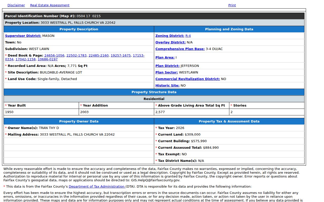
Its fields include a PIN, situs, owner, subdivision, deed books and pages, zoning, structure information, and assessment. The recorded deed itself is a separate Circuit Court or CPAN path, so the report should lead to the next official record rather than replace it.
Historic West Falls Church Neighbor Records
A block has a history as well as a current map. Fairfax deeds reach to 1742, though Civil War destruction left missing deed books from 1763 through 1819 and other gaps. The Historic Records Center holds pre-1945 deeds and historical tax books from 1851 through 1980. Jade imagery reaches back to 1937. A dated directory, tax-book clue, deed party, newspaper notice, and aerial image can be compared without assuming that one record proves continuous residence.
The Virginia Room and Library of Virginia are the historic fallbacks for directories, maps, microform, newspapers, and locality research. HRC staff can explain holdings, and courthouse staff can explain the index, but neither performs a complete property history on demand. Record each item’s date, repository, and relationship to the parcel.
Limits on West Falls Church Neighbor Lookup
There is no public, complete roster of a block’s households. Protected voter addresses, private utility and delivery records, DMV information, sealed records, and current civic membership lists are outside this workflow. The Virginia Address Confidentiality Program can provide a substitute mailing address and restrict the actual address. A deed party, owner field, or historic directory entry should never be converted into a claim about a person’s current home.
For a missing public record, use the appropriate channel: Jade and iCare online; courthouse or HRC for deeds and plats; the Virginia Room for historic directories; Fairfax Elections by phone or in person for election administration; and a precise county FOIA request for existing releasable administrative material.